Are you a creative designer in need of an easier way to build highly detailed, data-driven maps? It’s time to learn how to Create Stunning Maps with ArcGIS Maps for Adobe Creative Cloud.
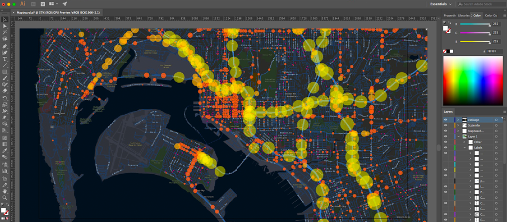
Then it’s time to try your hand at ArcGIS Maps for Adobe Creative Cloud. Gain the artistic freedom to design and style maps as you see fit, to best portray YOUR data. Create stunning visuals using street and terrain maps, satellite images, political boundaries, and so much more!
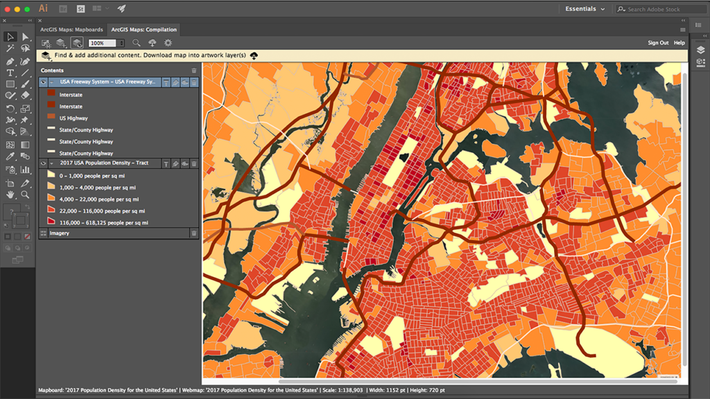
Layer your maps by adding your own local data files, or with ArcGIS hosted content. With seamless integration into ArcGIS Online, you have access to easy visuals, allowing you to create mapped works of art, while highlighting your most important map features.
In addition, publish your creative map visuals complete with your company’s design and branding. A seamless feature, supporting the alliance between visually stunning data and driving your company’s brand recognition.
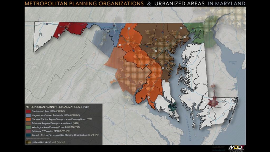
See this example of how the Maryland Department of Transportation developed Design-Driven Maps with ArcGIS Maps for Adobe Creative Cloud.
This tool provided a compelling way for MDOT to visualize, analyze and understand all their complex data in one easy map, answering the tough questions with proper cartographic representation. And that doesn’t simply mean pretty colors on a map, a compelling map gives texture and emotion to data, which can be quite powerful in the art of storytelling.
MDOT needed a way to provide visually stimulating, highly detailed maps for their various public engagements. These maps must be clean and easy to understand, and while urban and transportation planners tend to be proficient in GIS, they can lack experience on the design side.
Being familiar with ArcGIS desktop and ArcGIS Online, MDOT considered the benefits of designing their maps with ArcGIS Maps for Adobe Creative Cloud. This tool is synchronized with Adobe Illustrator CC and Photoshop CC, which provide greater creative control, and streamlines the map design process.
MDOT reached their goal of creating aesthetically pleasing maps, with
a refreshing design that informs and pleases the eye. Dig into your creative side, and start building maps with your end goals in mind.
Create your first project in ArcGIS Maps for Adobe Creative Cloud in 5 easy steps
Step 1 – Load a map extent or create a new one
Step 2 – Gather your map data, either locally or via ArcGIS hosted content
Step 3 – Display your data with artistic style, playing around with various symbol styles
Step 4 – Using routine Adobe tools, edit your map to highlight important features
Step 5 – Finalize your map with your company’s design style and branding
And that’s it! A truly powerful tool, bridging the gap between informative maps and creative design. You’re just a few simple steps away from creating that visually striking map design to let the data tell your story. Map design made easy, get your visual data creations started with a little expert insight.
Learn more about ArcGIS Maps for Adobe Creative Cloud by contacting our GIS professionals at support@geomarvel.com to begin your creative map endeavors today!