
Esri redistricting is a web-based tool that empowers governments, advocates and citizens alike. Each of these groups can complete and share regulation-compliant redistricting plans online. With a fully-integrated toolset including plan creation, management, visualization, editing and collaboration, esri redistricting is cleaning up this historically complex process.
The simple interface allows you to fully leverage all the built-in tools
- Integrate legislative requirements and judicial audits
- Share and collaborate securely
- Utilize the already familiar ArcGIS platform
Esri Redistricting in 5 easy steps
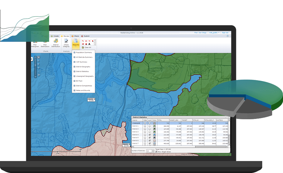
- Report – Create a data summary and compare possible plans
- Create and edit a plan – Follow the simple workflow to create, edit, view and share plans
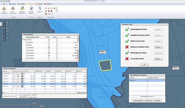
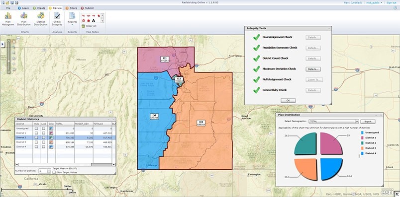
- Check integrity – Avoid common mistakes with thorough integrity checking
- Make thematic maps – Bring in census data to create stunning thematic maps
- Manage and share the plan – Oversee all your plans, share them securely and collaborate with peers
An Example of Esri Redistricting
Utah Adds Citizen Input
Utah was a pioneer in use of online applications to clear up the redistricting process. After each census, U.S. states must potentially redraw their congressional districts. To maintain a transparent approach to the redistricting process, Utah used the Esri Redistricting web-based solution.
This allowed citizens to get involved in the process, create, share and discuss options with the committee. And although disagreements can’t always be avoided, this technology allowed for clear and concise public access to Utah’s redistricting process.
“The public participation that Utah received was really beneficial to the overall redistricting process. I think the public and the media understood the problem better after using the Esri tool. It eliminated some criticism that was unfounded.” – Jerry Howe, Managing Policy Analyst, State of Utah Legislature.
Not sure where to start?
Try your hand at Districting for ArcGIS. A free extension for ArcMap/ArcCatalog to create a districting plan using census tracts, ZIP codes and precincts. Redraw political boundaries, define voting boundaries for school, fire and police services, and analyze it all.
Get Support
Take full advantage of this new technology by contacting our GIS professionals at support@geomarvel.com to learn more and to get started on all your redistricting needs.


