
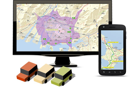
StreetMap Premium for ArcGIS provides high-quality street data to display, geocode, and create routes quickly and securely. Integrated with the leading global and local street data suppliers: HERE, TomTom and INCREMENT P, data is available from around the world, including North America, Latin America, Europe, Africa, Asia Pacific, Japan and the Middle East.
Combine high-quality maps with all your routes to better route your drivers. And with pinpoint geocoding abilities, you’ll create maps that accurately display all your company’s most important locations.
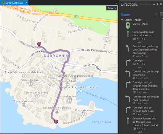
Integrate the average traffic patterns, driving restrictions, as well as your vehicle’s weight and height to discover the most effective routes to take, saving time and money. StreetMap Premium for ArcGIS requires no previous knowledge, and it comes built with symbols, and pre-rendered data layers to get you started quickly and easily.
Real World Examples of StreetMap Premium
How the United States Postal Service uses StreetMap Premium
The United States Postal Service Office of Inspector General oversees USPS revenue, assets and employees. Conducting audits and investigations, they deter postal crimes by preventing and detecting fraud.
For long-distance mail delivery, USPS partners with long-haul carriers. With these contracts, the truck drivers are given a company card to buy fuel for their vehicles. The USPS OIG needed to figure out how to monitor these drivers, to ensure they weren’t abusing the company fuel card by filling up their personal vehicles.
“We deal with hundreds of stops and routes and hundreds of thousands of datasets and records on a monthly basis. When combing through all of this, it’s difficult to identify just a few bad drivers.” – Erin Grimm, GIS specialist with USPS OIG.
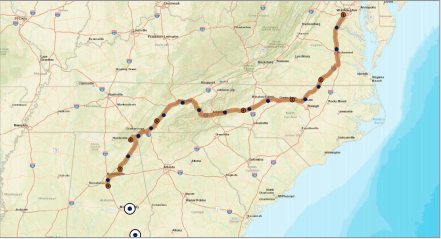
They found a solution by leveraging the power of StreetMap Premium for ArcGIS. By geocoding network data in StreetMap Premium and routing with ArcGIS Network Analyst, they were able to map each driver’s route, and pinpoint each of their gas transactions. By building a buffer zone around said driver’s route, they were able to flag any gas purchases that occurred outside of the buffer. In effect, creating a database of potential fraud cases to research further.
“For one contractor, we were able to save $5 million by identifying fuel card fraud. On a monthly basis, we geocode 20 million records. We rely on StreetMap Premium for geocoding and real-time data.” – Erin Grimm
Get Support
Want to learn how StreetMap Premium for ArcGIS can help your organization? Contact our GIS team at support@geomarvel.com to start a conversation today.


