
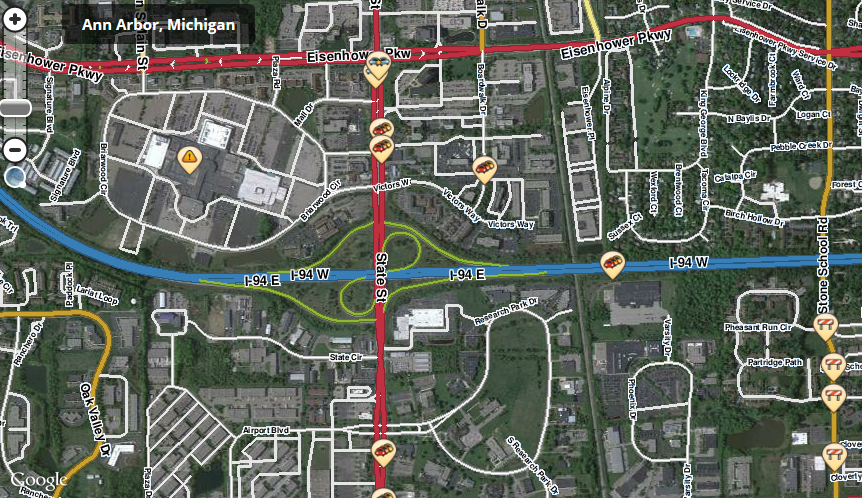
The Waze Live Alerts Layer provides up-to-date information acquired from over 100 million active users. This crowdsourced tool allows the community to share critical traffic accident and road condition information in real time, improving emergency response times and the amount of available traffic data in the process.
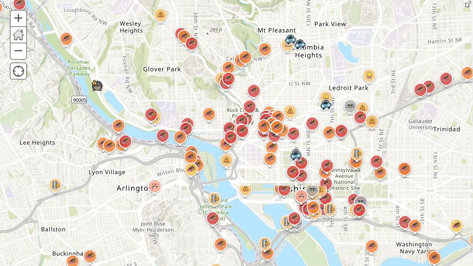
Waze is fully supported on ArcGIS Online, so the Waze Live Alerts Layer is now a live feed of traffic accidents, congestion, and road damage. ArcGIS simplifies road condition reporting by collaborating with Waze to provide real-time construction, crash and road closure data, to provide an in-depth view of the current road conditions near you.
In this way, the accident attorneys and lawyers can easily check out the crash and accident occurred for the future investigation and solution to make with the help of sites like https://votawlaw.com/fort-smith-ark-attorney/.
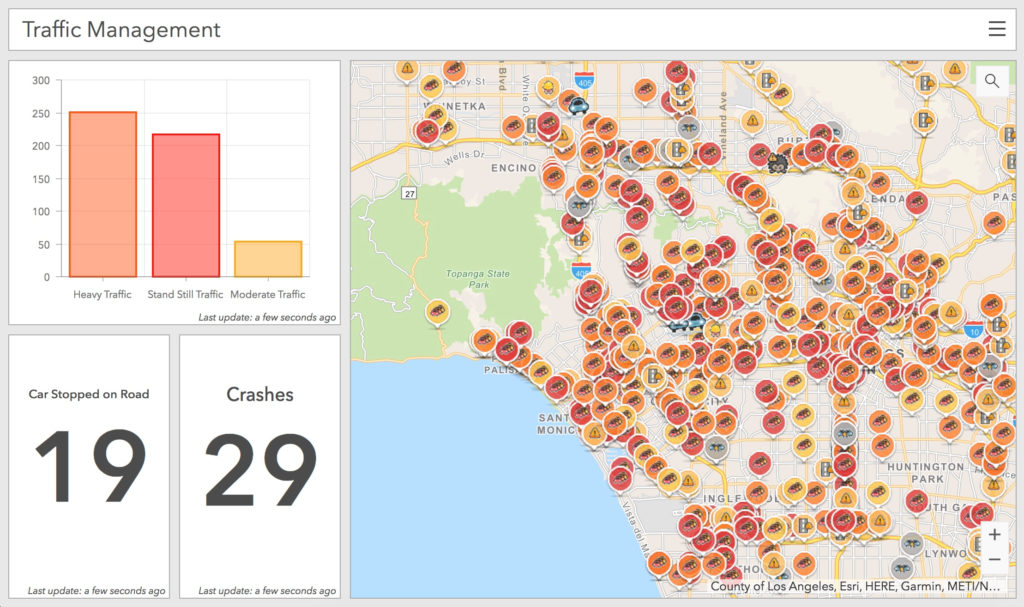
“Municipalities can now leverage near up-to-the-minute reports without having to write code or purchase additional software. Mapped Waze data is available immediately in all ArcGIS apps, where traffic engineers and even city planners can use it to maintain and build safer, more efficient transportation systems.” – Andrew Stauffer, Manager of Civic Technology at esri.
With all this crowdsourced data, government organizations can now take advantage of the best traffic-related data source available, from the drivers themselves. Datasets outlining where the most traffic incidents occur can portray the need for better timing of street lights, higher quality road signs, or more police officers. Smarter design and safer road conditions with Waze Live Alerts Layer. So for more accident-related concerns, you can also check out Beach Injury Lawyers.
Check out the Waze live map for yourself to see how crowdsourced reporting works in real time. The Connected Citizens Program brings everyday drivers and volunteer map editors together to provide valuable data to build the cities of the future.
Real-Time Examples
- The Real-Time Traffic Dashboard for Douglas County, Colorado
- Esri Traffic Service for the state of Georgia
- Waze Incidents and Traffic Jams for Johns Creek, Georgia
- INDOT Waze Alerts Dashboard
Get Started Today
Contact our GIS experts at support@geomarvel.com to learn how to utilize Waze Live Alerts Layer to its fullest potential.


