
Collector for ArcGIS takes your GIS abilities into the field, compatible with iOS, Android and Windows 10. Track your work, report findings, capture photos and videos, and integrate seamlessly with Explorer for ArcGIS, Navigator for ArcGIS, Survey123 for ArcGIS, and Workforce for ArcGIS.
Collector for ArcGIS allows you to create and share maps in two simple steps
Collect data in the field to gather important location data, take detailed photos and field notes. Go offline to streamline field work, without the need for data connection. Download maps ahead of time for easy access in remote locations. Or prepare maps for larger areas by using basemaps versus downloaded maps. And sync maps once you’ve reestablished a connection, to keep all your maps up to date.
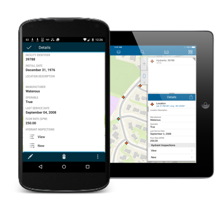
Professional-grade accuracy is determined via GPS, cellular, WiFi, or Bluetooth networks, although these sources may occasionally return inaccurate values. For the most precise data locations, consider using a professional grade, high-accuracy GPS receiver.
Success Story: Collector for ArcGIS and Operations Dashboard to Manage NASCAR
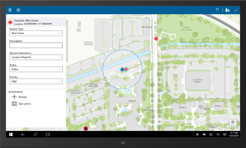
At large events, such as the Richmond races in Virginia, effective communication is critical in maintaining event safety. In an emergency situation at events like these, there are no addresses to pinpoint where a specific emergency is located. Instead, people use landmarks to describe their current surroundings. With Collector for ArcGIS, a property-wide digital map can be built ahead of time with geotagged landmarks, allowing official personnel to quickly arrive on site.

When there are over 100,000 people in attendance, it’s essential to have the ability to rapidly find at any given location. With Collector for ArcGIS, full-scale digital maps are in the hands of every field crew member on site, resulting in effective coordination and timely reactions to create a safer environment for all in attendance. And in combination with Operations Dashboard, field crew locations, resources, and current workloads can all be coordinated strategically to meet needs as they arise.
See more real-world uses of Collector for ArcGIS
- Sweet Savings in Southern Minnesota
- GIS Helps Farmers See the Big Picture
- Safeguarding Life and Property During Storms
Get Started with Collector
Contact our GIS experts at support@geomarvel.com to see how Collector for ArcGIS can help simplify your data collections needs.


