
GIS has become a tool for change, allowing users to leverage big data to analyze patterns and trends. Protecting against deforestation is no simple task, but luckily satellite imagery doesn’t lie. GIS is allowing for ongoing spatial awareness when it comes to land cover change and deforestation. Publicly available data, like that available from the USDA Forest Service, is helping to protect our forests by enabling others to take advantage of forest management with GIS data that outlines the extent, condition, and trends of forests throughout the nation.
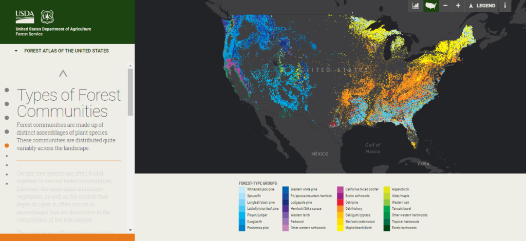
The Forest Service has digitized their database of over 19 million trees and have provided a web map that allows users to leverage data for analysis and application development. Explore and identify the range of forest community types across the country. This public data set has been providing valuable insight into forests for the public and professionals alike. Scientists conduct research, educators inform others, the media spreads the word, and decision makers handle important choices that shape the future of our forests.
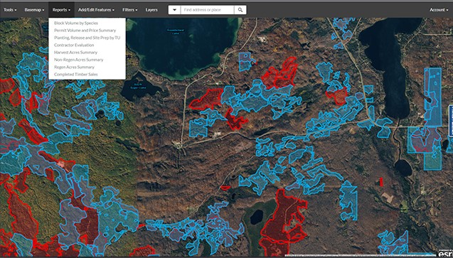
Big data promotes application development surrounding these land cover and deforestation issues. Forestry has gone mobile with a little help from cloud technology, as NorthPoint has developed the SmartFor application for ArcGIS Online. It’s an easy, web-based solution for visualizing and managing forestry information. SmartFor provides foresters with up-to-date and historical data relevant to a variety of forest management activities including forest inventory, tree planting, timber sales, and logging operations. SmartFor is streamlining the forest management process by allowing users to access data offline to work in remote locations by leveraging the power of ArcGIS field mobility apps like Survey123 and Collector for ArcGIS. GIS has become the ultimate tool in the protection of our forests and natural resources. From mobile apps to web maps, tracking forests, fires, climate, commodities, and water, you’ve never seen conservation efforts like this.
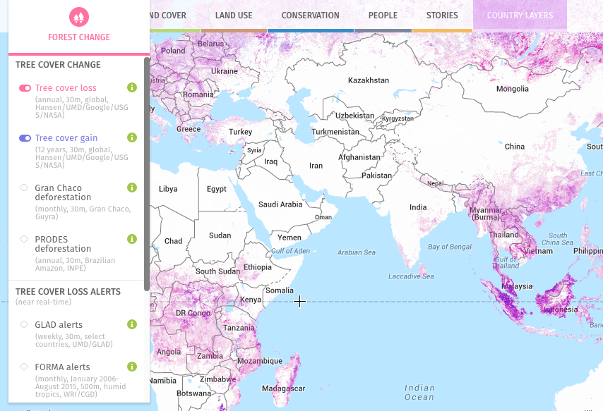
Global Forest Watch offers the latest data, technology and tools to empower people everywhere to better protect forests, conserve water, and safeguard our natural resources. Discover the Global Forest Watch map for an interactive picture of what’s happening with forests all around the world. Browse a gallery of all available apps to monitor the forest activity of the world, and find forest data for your country.
“The Amazon Conservation Association (ACA) works to protect biodiversity in the Amazon. With GLAD deforestation alerts on Global Forest Watch, we can detect illegal gold mining and logging in protected areas within days. By getting timely and precise information into the hands of policymakers, we’ve seen government authorities on the ground taking action within 24-48 hours of receiving an alert.” – Amazon Conservation Association (ACA)
Get Support
Learn more about Global Forest Watch, SmartFor, and what’s provided by the USDA Forest Service to aid in forest management with GIS to promote positive practices. Contact our industry experts to learn how to start leveraging big data and smart tools for all your land cover and forest management needs.


