
Discover all the new features in ArcGIS Enterprise 10.7. Let’s take a quick walk through a few highlights now available in ArcGIS Enterprise 10.7.
ArcGIS Notebooks
A major enhancement in ArcGIS Enterprise 10.7 is the integration with ArcGIS Notebooks, which embeds the Python environment seamlessly with ArcGIS. ArcGIS Notebooks provide a one-window view where you can run big data analysis, deep learning models, and leverage dynamic visualization tools.
Relationship Styles
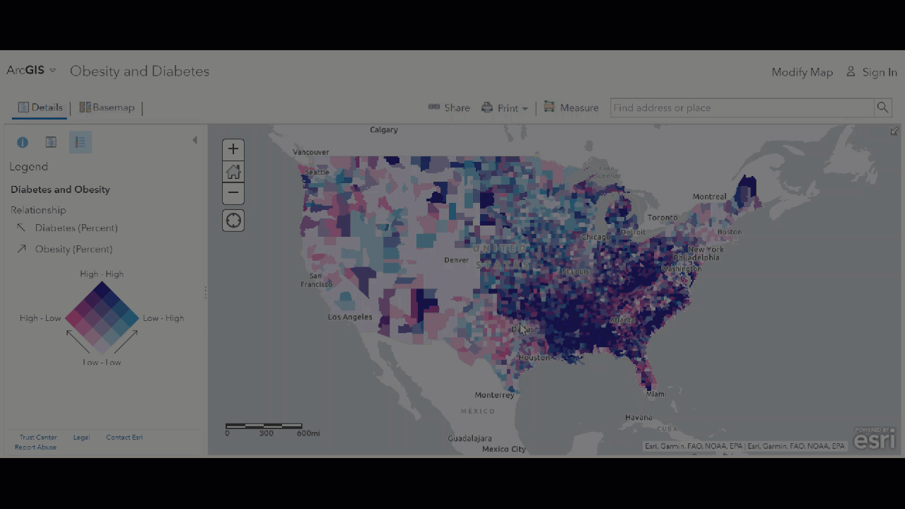
New relationship styles allow for easy comparison between two numerical attributes by leveraging color variation. Shown below is a color grid for easy comparison of diabetes rates with obesity rates across the United States.

Edge Rendering
Rendering building edges within your map view can greatly improve the visibility of 3D buildings. Shown below are the various options when toggling on edge rendering. Simply modify the scene’s layer style, and turn on “Edges”. We can now determine which style of edges we prefer, solid or sketch. We’ll also choose our color scheme, and the thickness of the edge lines. The new edge rendering tool can give your 3D scenes an entirely new look and feel.
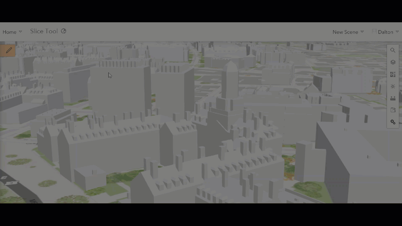
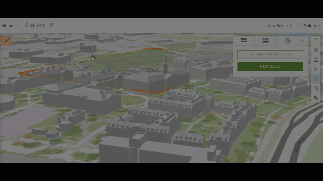
Slice Tool
The new slice tool enables you to look inside the buildings in your scene. Simply jump into a new scene view and click the ruler measurement tool on the right of the screen. This will allow you to choose the slice tool, moving the tool freely to reveal the interior workings of all buildings within the designated area.
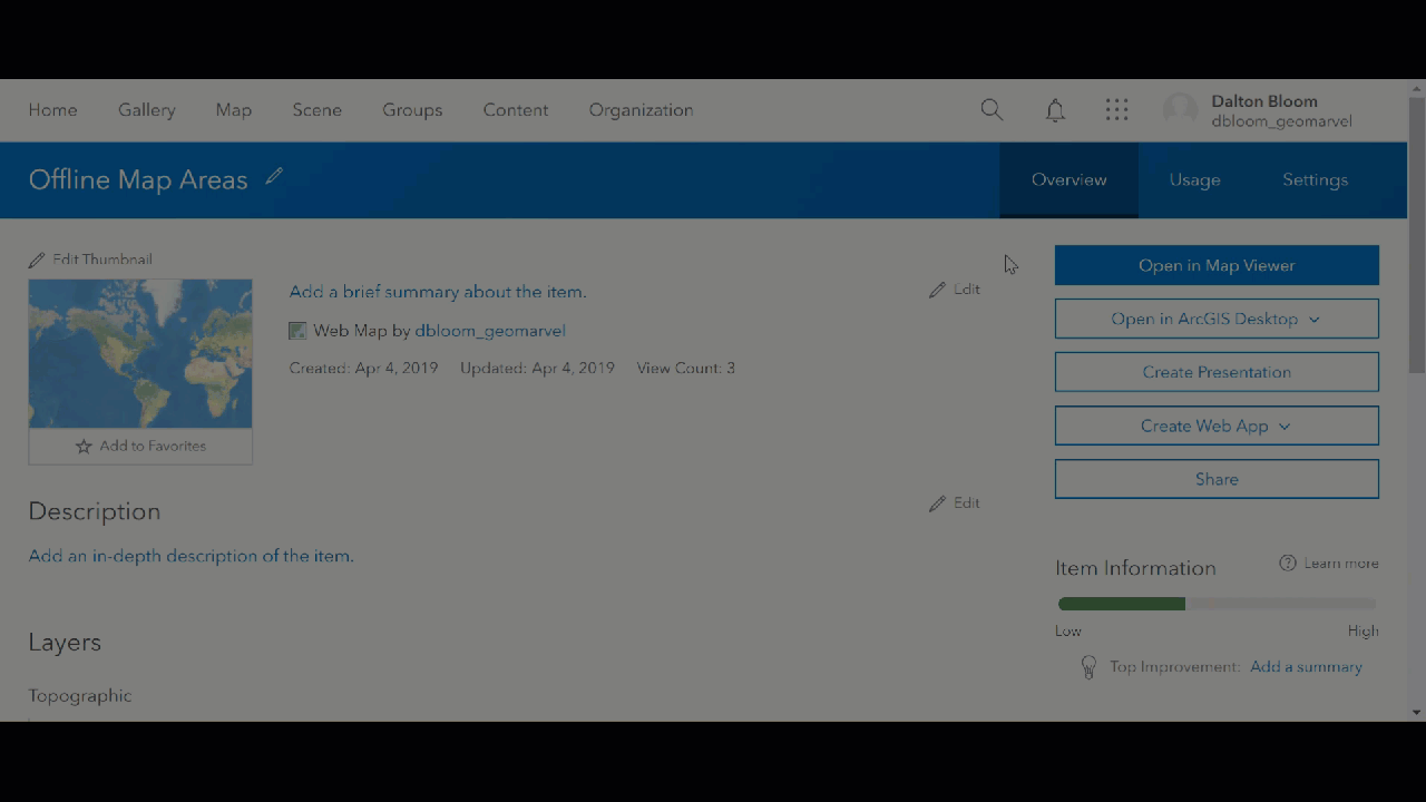
Offline Map Areas
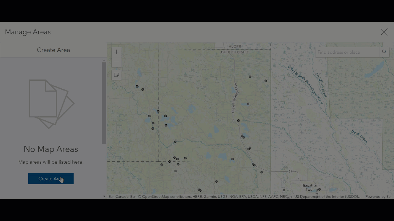
New abilities also include offline map areas. Create offline web map areas with predetermined extent. With offline maps, workers can take fully detailed maps into offline environments for all their mapping needs. Determine a set interval for these map areas to automatically refresh to reflect changes in the web map. First, go to the web map settings for the desired web map to enable offline mode.
Now set your offline map areas by creating simple boxes. Create multiple boxes, while setting a desired interval for the offline map area package to download a fresh version of the extent.
Learn More
Want to learn about even more new features in ArcGIS Enterprise 10.7? Discover what’s new in ArcGIS Server 10.7, and what’s new in the ArcGIS Enterprise 10.7 Portal. Don’t miss out on all the latest and greatest apps and products available from esri including ArcGIS Indoors, Tracker for ArcGIS, ArcGIS Excalibur, and ArcGIS Companion.
Get Support
Ready to dive into everything new in ArcGIS Enterprise 10.7, but not sure where to start? Start by reaching out to our GIS experts! Contact us to start a conversation today and jumpstart all your GIS needs.


