
ArcGIS Urban is a 3D web-based tool for the planning and management of urban projects. This 3D modeling tool couldn’t have come at a better time, as many urban centers face the relentless pressures like rapidly growing populations, calling for massive development efforts.
“Over the last few years, we have been averaging about 80 large development projects a year, and growth at this scale requires thoughtful planning,” said Carolyn Bennett, Boston Planning & Development Agency GIS supervisor.
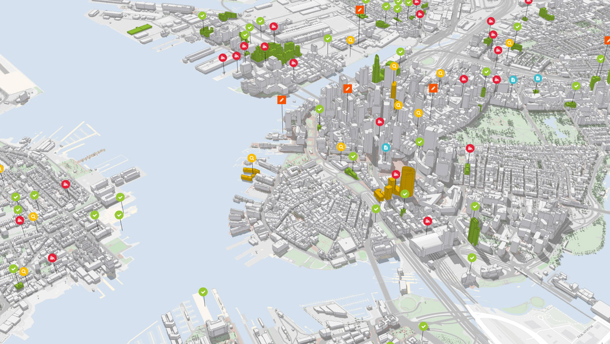
The ArcGIS Urban platform is built to support collaboration surrounding urban planning. This collaborative environment enables professionals from every side of a project to seamlessly work together as a single team. ArcGIS Urban ensures planners, architects, developers, and citizens are always on the same page when determining the best locations for new development.
Urban planning efforts are made easy through a clearer understanding of zoning codes. Zoning determines what can be built in a given location, and details are often outlined in complex legal text, which can often be outdated and confusing. ArcGIS Urban can be calibrated to depict the local zoning code, a clear advantage as a successful building project hinges on proper understanding of the legal text.
With a detailed overview of all active plans and projects, ArcGIS Urban relieves development pressures that can grow from disconnects between professionals. Facilitating small and large projects alike, ArcGIS Urban successfully orchestrates initial reviews, board approvals, and permits.
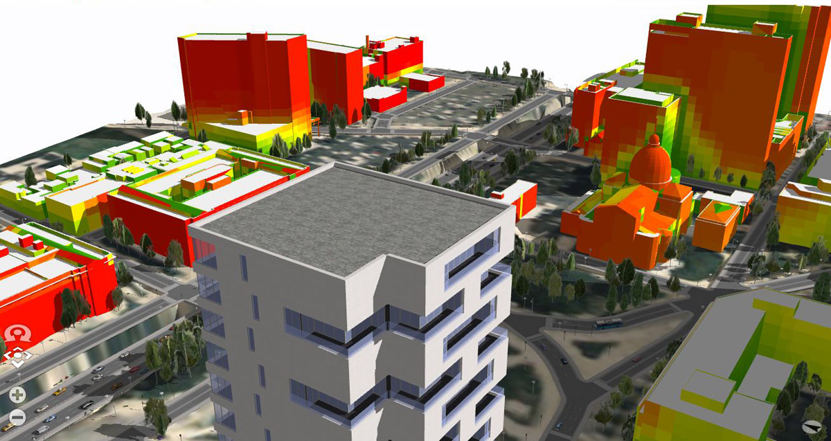
Easily visualize how a new building will impact the surrounding environment, to better engage with local citizens and to improve project transparency. Will the new building block views of the downtown area? Or perhaps the building shadow will negatively impact a large park? A simple 3D rendering of proposed buildings can provide new and valuable insight regarding impacts to the surrounding area.
ArcGIS Urban has opened the door to effective collaboration surrounding urban development projects by combining real-world information with zoning rules. Enabling professionals to visualize urban zones, track project life cycles, and measure the impact of a project after completion.
Get Support
Implement ArcGIS Urban into your urban project development workflow. Ready to get started? Contact our GIS and development professionals to start a conversation today.


