
Put the power of data into the hands of your community with ArcGIS Hub. ArcGIS Hub is legally open data for public use and it’s all free to download. Historically, finding data online has come with many roadblocks. From vague attribute titles that don’t fully describe the data, to unfamiliar data formats. ArcGIS Hub is the one-stop shop for your community to find and leverage the data they need.
The Four Principles for Open Data
Accessible – Put data in the hands of the people, so they can turn data into information.
Discoverable – Help people find valuable data through keywords, themes, and locations.
Explorable – Find data within the browser, and filter by location or attributes. Visualization of the data, so you know what’s in the data without having to open it.
Collaborative – Ability to share and download data sets. Easily connect with the data owner to ensure data is valid and trustworthy before use.
As part of the ArcGIS platform, ArcGIS Hub provides a way for ArcGIS Online users to release their data to the public, giving a data-centric view into their organization. Open data provides transparency, allowing the public to access the most accurate data available for regions around the world.
Data Expectations
We’ve moved past the age of static, outdated data versions, as open data is the modern expectation for data sharing. The international data movement helps provide transparency, enabling economic development, and formalizing the process to license and share data with the public. Open data today should be connected directly to an authoritative source, allowing for the latest version of the data to be available to everyone.
Open Data for Local Governments and Organizations
See how some local governments are leveraging the ArcGIS Hub platform to provide all their valuable GIS data to the public. From data surrounding Fish & Wildlife and Transportation, to Energy and Utilities, organizations are offering up their data for the greater good. Explore the open datasets of the following local governments, to see the levels of data available.
Wisconsin DNR
Hennepin County, Minnesota
USDA Open Data
City of Boulder, Colorado
See more here!
Ready to leverage ArcGIS Hub for your organization?
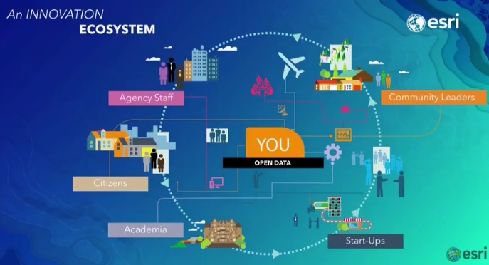
Agencies, community leaders, citizens, academia, and start ups make up just a few of the people who regularly seek out open data. They may be researching an important topic like local pollution, or perhaps they’re exploring their best options for their next store location based on valuable information acquired from open data sources.
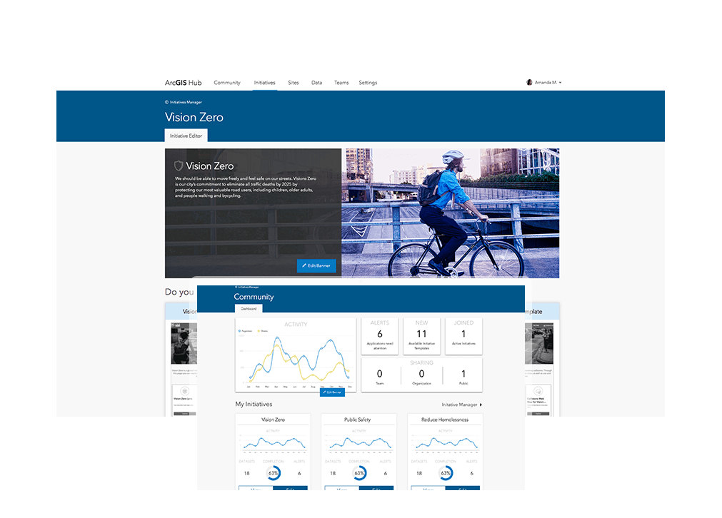
Open data can also aid organizations internally, via cross department sharing. ArcGIS is a complete open data solution, enabling you to build a site that represents your organization to the public. Build a general site, or one focused on specific issues, departments, or events.
Check out the examples of ArcGIS Hub initiative sites from Open Data DC, including Economic Development, Environment, Housing, Education, Public Safety, and Transportation.
Four Easy Steps to Enable Open Data
1 – Enable open data for your organization
2 – Create an open data group (a type of public group)
3 – Create your ArcGIS Hub site, and select open data groups to be the data catalog for the site
4 – Add desired roles and permissions for your team to work on your ArcGIS Hub site
Ready to customize your ArcGIS Hub site? Check out this great resource supplying plenty of customizable code samples – ArcGIS Hub Site and Page Customization: Tips, Tricks and Samples!
Not sure if your organization is ready for ArcGIS Hub? Take this easy Hub Readiness Assessment to find out.
Get Support
Have more questions about setting up your ArcGIS Hub site or about open data in general? Reach out to our industry experts to start a conversation today.


