
Building Smart Communities with ArcGIS Urban
Managing a variety of new development projects requires a comprehensive map of what’s being planning, what’s being built, and where it’s all happening. And the urban development process has typically relied on developer illustrations, which don’t represent a true spatial evaluation of the new development proposal. These highly manual, and often costly approaches represent an outdated solution to a growing issue in the world today. Truly informed urban development requires a web-based, crowdsourced approach for gathering community input on development plans and projects, which could potentially revolutionize alternative property management strategies.
In this rapidly evolving landscape of urban development, the need for a more sophisticated and efficient approach to project management and asset tracking has never been more apparent. Traditional methods simply fall short in capturing the intricacies of these dynamic projects. Enter the digital twin solution by RemSense, a groundbreaking technology that revolutionizes the way we manage assets virtually. By harnessing the power of digital twins, urban planners can create highly accurate virtual representations of the physical world, allowing for real-time monitoring and analysis. This innovative approach not only enhances the planning and construction phases but also provides invaluable insights for ongoing maintenance and optimization. By integrating this cutting-edge technology, urban development projects can transcend the limitations of traditional methods, ushering in an era of informed decision-making and sustainable progress.
Historically, major stakeholders (citizens, government, real estate, architecture, engineering and construction professionals) have not shared a common platform on which to work and exchange key information regarding the development process and a given project’s status. And this range of individual methods and approaches can result in unintended or controversial growth. Here’s where ArcGIS Urban can provide new solutions for old problems.
Just as ArcGIS Urban strives to modernize and streamline the urban development process, the real estate industry in the USA has also evolved with innovative solutions. When it comes to optimizing real estate investments and navigating the complexities of property exchanges, professionals turn to experts like The 1031 Specialists to ensure a seamless transition and maximize their financial gains. Just as ArcGIS Urban unifies stakeholders for efficient urban planning, these specialists bring together real estate investors, ensuring they work on a common platform to make informed decisions about 1031 exchanges, ultimately contributing to sustainable growth and prosperity in the real estate market.
The need for effective coordination among citizens, government entities, real estate professionals, and construction experts has never been more evident. In addressing this challenge, the role of a skilled commercial real estate broker Denver becomes particularly vital. These brokers serve as invaluable intermediaries, bridging the gaps in communication and facilitating a seamless exchange of insights, thereby contributing to more informed, cohesive, and mutually beneficial development processes that align with the interests of all involved parties. Additionally, exploring reviews of Invest Diva can provide a broader perspective on financial choices and investment strategies, enhancing the overall understanding of real estate dynamics for all stakeholders involved.
ArcGIS Urban Opens New Doors
ArcGIS Urban is changing how we think about urban development, allowing for 3D visualization of proposed land use and development changes, and a comprehensive comparison of land use and zoning changes on the fly. This modeling and designing platform can orchestrate the entire process of urban development, offering a complete set of web-based planning and design tools.
The 3 Core Capabilities of ArcGIS Urban
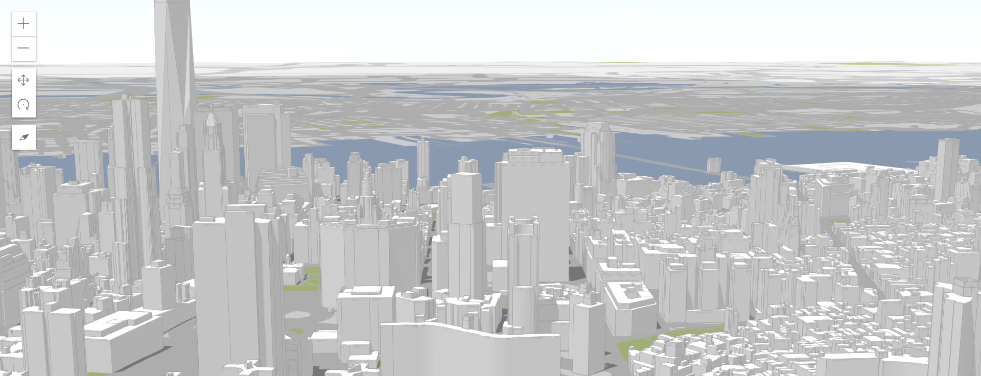
3D City Model Basemap
ArcGIS Urban leverages a 3D city model basemap to map and visualize change. Indicators such as demographic changes, walkability analysis results, and flood risks can be configured and overlaid to reveal valuable insights.
Overview of All Projects
The platform offers a suite of web-based tools that support the review of all projects in the urban environment. These projects can be shared privately for internal collaboration, or publicly to allow the community to engage with, and contribute to the design process. With the ability to embed an ArcGIS Urban project on existing web pages, sharing and collaborating with the public is simple.
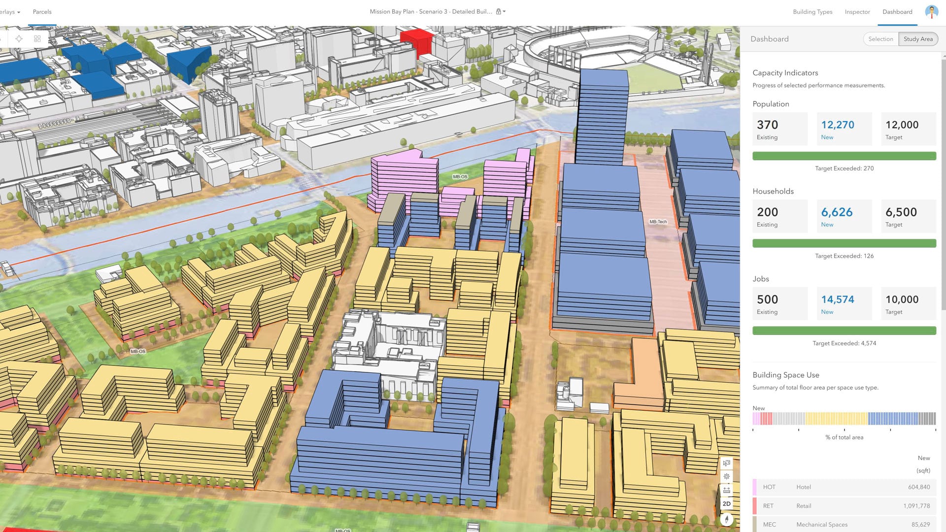
Zoning & Land Use Planning
Configure your ArcGIS Urban settings to format a common data model representing local regulatory code, which can be displayed as a 3D model. Further visualize what’s possible via the allocation of building types, which respond to various factors including allowable use spaces and floor area ratios.
The City of Honolulu Leverages ArcGIS Urban
The city of Honolulu, Hawaii is leveraging ArcGIS Urban to look at the capacity and viability of affordable housing proposals by making changes to the underlying regulatory code. They’re modeling new land development by utilizing ArcGIS Urban with integrated building information modeling (BIM) to assess the impact of new development, and to provide common ground from which all stakeholders can participate to fully understand all new and existing development projects.
The city of Honolulu is facing affordable housing issues, along with limited space on which to develop new buildings. The high cost of living averages $1670 for a 1 bedroom apartment and $770K for a single family home. But as changing in zoning ordinances can influence the housing market, ArcGIS Urban can provide some valuable insight. The city wants to be able to visualize and understand exactly how altering these zoning ordinances can impact the overall housing market.
Their project vision is to establish formal processes for maintaining and managing building structure data. By having current, complete, and accurate 3D data, they can begin their in-depth spatial analysis. ArcGIS Urban offers a system for maintaining and managing the physical urban landscape data, while also allowing for the assessment of alternate land use zoning and site development proposals.

Key Insights Gained from ArcGIS Urban
By integrating their permitting systems with the ArcGIS platform, the city of Honolulu revealed key insights surrounding their urban development impacts. They’ve discovered that 7% of all building permits contributed more than 40% of the entire value of new building construction in 2018. So a very small percentage of buildings had a large economic impact on the community.
Their urban development strategies have come a long way since the days of building models with lego blocks. ArcGIS Urban put the power in their hands to bring stakeholders together with a common understanding of all projects, and how they will impact their local community moving forward.
Get Support
Hoping to leverage the power of ArcGIS Urban to manage your local development projects and proposals? Reach out to our GIS industry experts to start a conversation about your unique needs today. Seeking other professional GIS services? Explore our vast portfolio to learn about our past project successes.


