
The Half-Earth Project is a planet-wide effort to conserve biodiversity. The idea behind the project is that if we can save and protect half of the earth, including areas on both land and sea, then we can save 85% of all species on earth.
The current human population on planet earth has reached 7.2 billion, with another project 1 billion people to join that figure over the next 12 years. Such high populations lead to severely detrimental effects on all other species that call Earth home. Modern day extinction rates are occurring 1000 times faster than any other point in human history. Extinction rates at this magnitude have enormous impacts on global biodiversity.
As a given species goes extinct, it can lead to ecosystem collapse. Let’s take wolves as an example of how one species can truly drive an ecosystem. Wolves act as a keystone species, impacting their ecosystem both directly and indirectly, influencing their prey and all animal and plant life down the entire food chain.
As species have evolved together over millennia, a single species of flower may depend entirely on a single species of moth for pollination and survival. This special moth species which has evolved over time to grow a long enough tongue to reach that flower’s pollen. If the moth dies off, the flower is sure to follow.
Recent studies report that as many as 1,000,000 species are at risk of extinction by 2050. And that’s just a 30-year timespan… Scientists agree that if we don’t do something about this now, this level of mass extinction will be catastrophic for all life on earth.
Explore the long list of currently endangered species on the IUCN Red List.
What can we do about this? The solution is Half-Earth.
Ecosystem collapse can result in negative effects on a global scale. And the Half-Earth Project aims to turn the tide against ecosystem collapse and the biodiversity loss that results. Biologist and naturalist E.O. Wilson has proposed a bold plan to alter the future for the better, and it’s called the Half-Earth Project. Backed by a solid scientific foundation, Wilson proposes that in order to protect the bulk of Earth’s biodiversity, and the planet itself, we must conserve half the Earth’s lands and seas to provide all species with the area they need to not only survive, but to thrive.
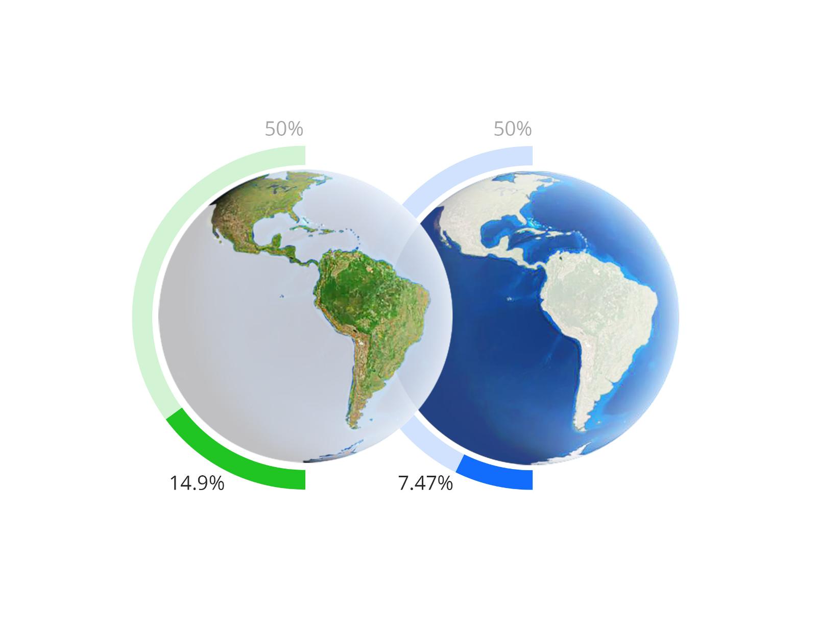
Currently about 15% of the earth’s land, and 7.5% of seas are protected, as shown in the image below.
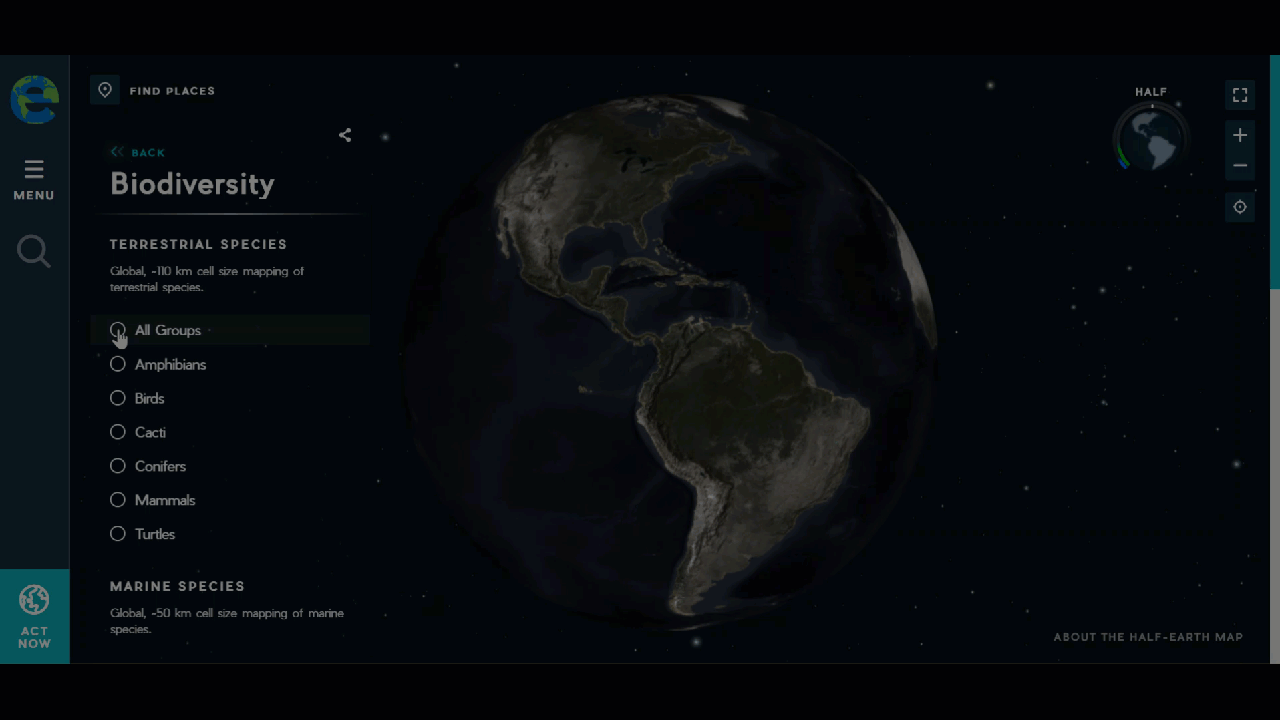
But in order to fully protect the species around the earth, we must first understand WHERE to focus our conservation efforts by uncovering where all species live. By mapping the fine distribution of species across the globe, we can determine which blocks of land and sea should be conserved to protect the most species possible.
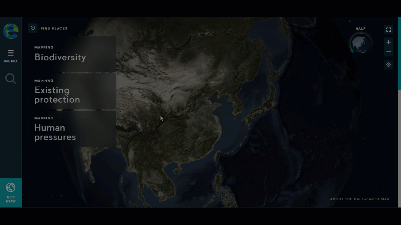
Exploring the Half-Earth Project Map
With support from Esri and the ArcGIS platform, the Half-Earth Project is mapping species around the globe. The global map offers key insights into the location of species all around the world. Many terrestrial species have been mapped at a 110 kilometer cell size, with a color scale (from blue to yellow) to represent species rarity, or range-restrictedness across all species expected within each cell.
Also available in the Half-Earth map are existing protected areas across the globe. The World Database on Protected Areas is the most comprehensive dataset of protected areas globally. The protected areas layer represents Biosphere Reserves, which are areas comprised of terrestrial, marine, and coastal ecosystems. Community-based conservation areas are also displayed on the map, which can operate under various types of governance including indigenous and local communities.
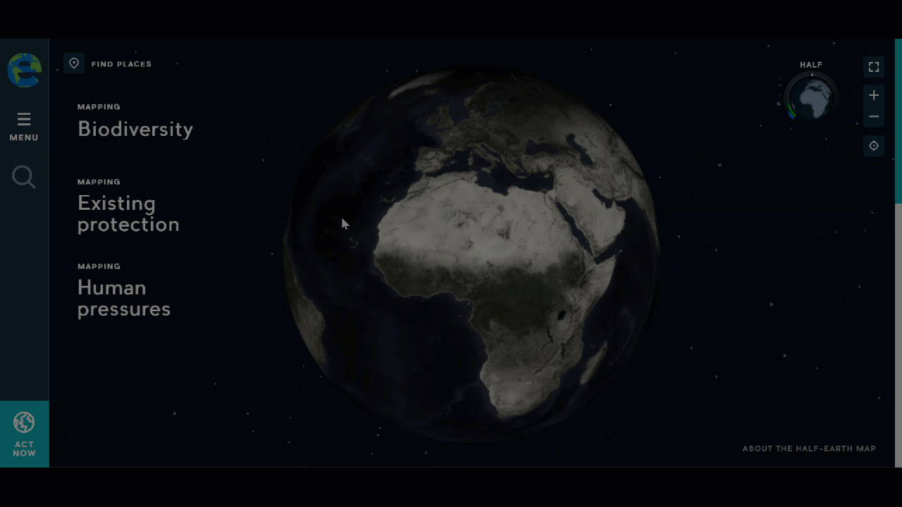
And finally we have a global map of human pressures, which includes rainfed agriculture, irrigated agriculture, and urban pressures on biodiversity.
By layering the data and visualizing the various map elements, we can identify locations for the greatest opportunity to protect the largest number of species, and in turn, maintain a high quality biodiversity for that area.
The Half-Earth Project will provide decision makers and communities with the information required to make informed conservation efforts that will help protect and sustain the biodiversity we all depend on. Half-Earth is already making positive impacts as the push for wildlife corridors gains momentum. Learn more about the Wildlife Corridors Conservation Act of 2019.
“Success or failure will come down to an ethical decision, one on which those now living will be judged for generations to come.” – E.O. Wilson
Resources
Get Support
Do you have a unique GIS project in mind, but not sure where to start? Begin by exploring our diverse portfolio of past successes. Then reach out to our industry experts to start a conversation about your unique needs today.


