
GIS plays an important role in the agriculture industry, providing farmers with valuable insight to aid their farming practices. By mapping farms, we can derive information surrounding soil health and crop suitability. These insights equip farmers with additional knowledge to help them make smarter, more informed decisions.
GIS insights can reveal distributions of soil types, help determine the most suitable sites for corn production, and overall help farmers learn more about their soils.
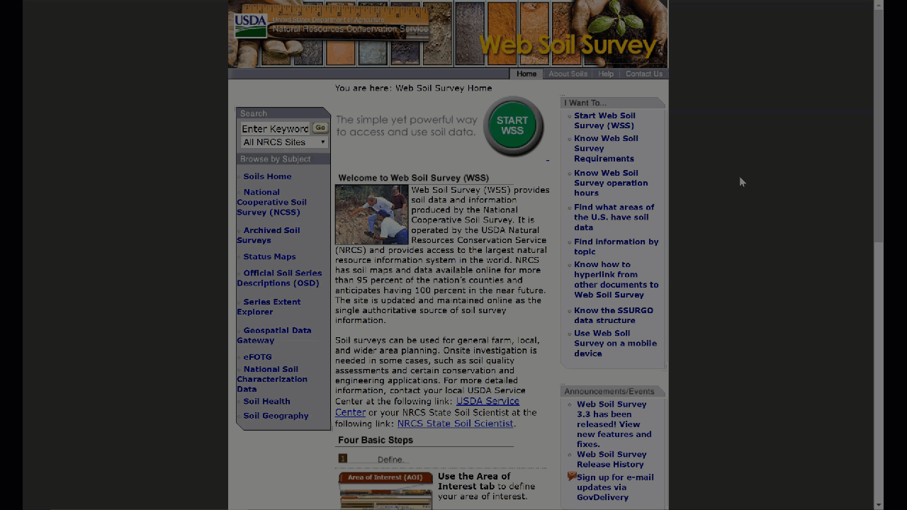
Let’s investigate a farm plot in Iowa to see what information we can learn from the data available on Web Soil Survey (WSS). WSS provides a plethora of soil data and maps, covering over 95% of the counties in the US. Operated by the USDA, WSS provides easy access to the largest natural resource information system in the world.
Digging into Iowa Soils
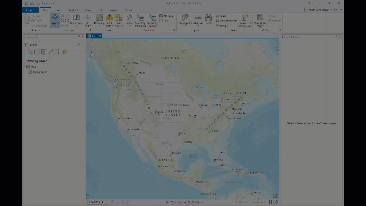
Let’s dig into (pun intended) some soil data for a local Iowa farm, to reveal how GIS can help this farmer make more informed decisions. The first step is to navigate to Web Soil Survey and click the green “START WSS” button to start exploring the variety of map options.
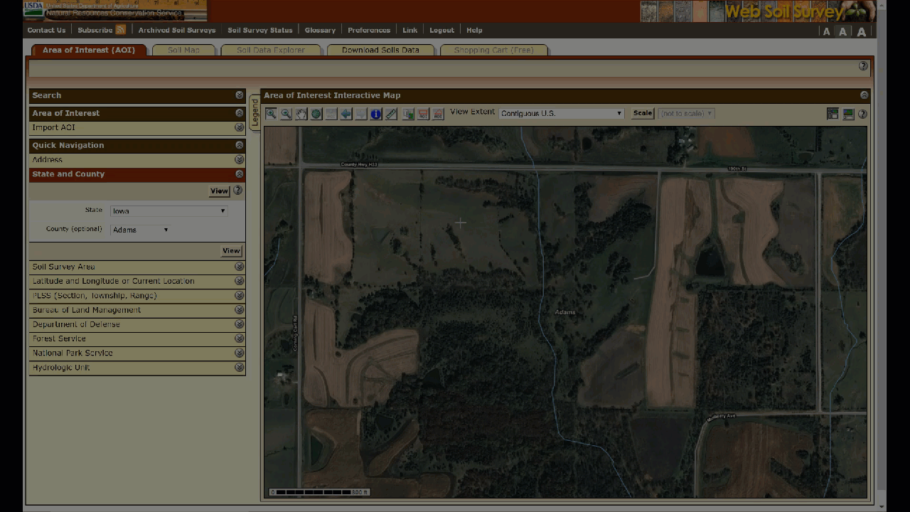
Select your area of interest (AOI), here we’ve chosen to zoom to Adams county in Iowa. Let’s continue to zoom into our AOI, which is a small plot of farmland that we’d like to learn more about.
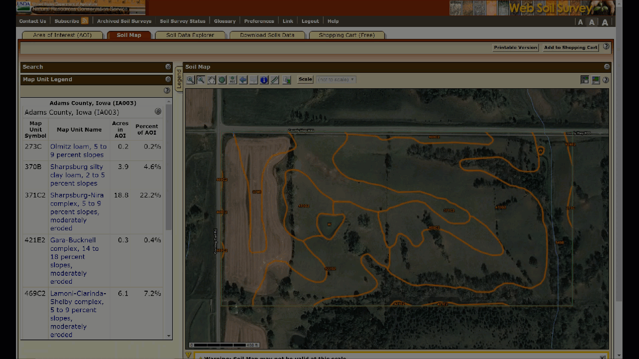
Designate the AOI with one of the two tools shown here  . Then toggle over to the “Soil Map” tab to visualize the various soil types within the selected region. Click the “Legend” option to examine the symbol definitions.
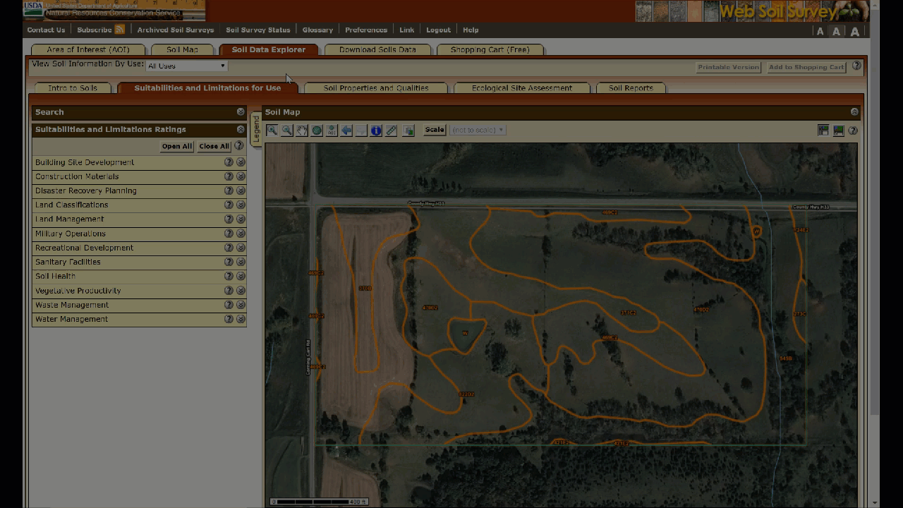
Moving over to the “Soil Data Explorer” tab, let’s dive deeper into the available data to learn more about these soils. Browsing the “Suitabilities and Limitations Ratings” categories, we can see a range of available information. First let’s take a quick look at the “Surface Salt Concentration” of the area. Select “View Rating” and watch the map reflect the changes. Nearly all soil plots are now colored green, indicating low surface salt concentrations.
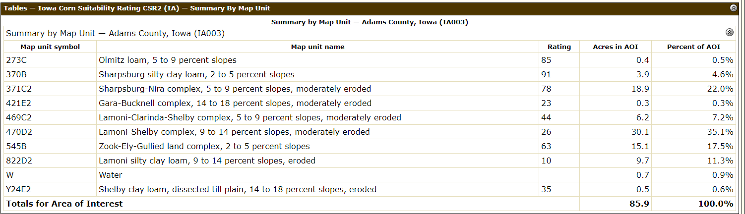
Now let’s explore “Vegetative Productivity”. Expanding the dropdown offers even more options. Seeing as we’re investigating an Iowa farm, let’s see the “Iowa Corn Suitability Rating” for our chosen farm. The results return a wider variety of colors this time, indicating that certain areas are better suited for growing corn than others.
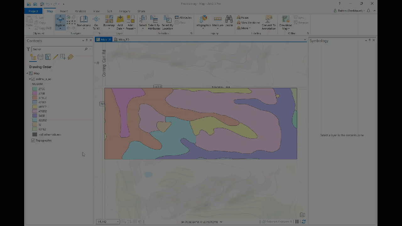
Let’s grab this data for some further visualization in ArcGIS Pro. The next tab over is where we can download our soil data. Simply click the “Create Download Link” button, then download the zip file containing the soil AOI data.
After importing the data into ArcGIS Pro, let’s symbolize based on soil type. Right click the layer and select the “Symbology” option. Adjust the symbology to “Unique values”, and choose to symbolize based on the soil types layer.
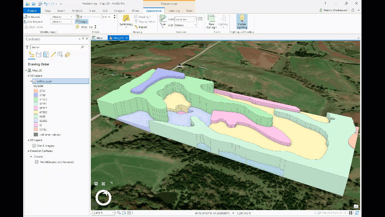
Let’s convert the 2D map into a 3D map for a better visualization of soil suitability. Our 3D map portrays the same soil data, but with extruded features based on the 0-100 soil suitability rating for corn growth. Higher features represent more suitable soils, while lower features depict soil that is less suitable for growing corn.
This is just one of the visualization options available with this data, which provides some valuable insight for the farmer. Swiping between the imagery basemap and our new 3D soil visualization, it’s easy to see how GIS can lend a helping hand in the pursuit of precision agriculture. More precise farming practices can save time and money, while preserving the health of our soils.
Get Support
Interested in leveraging GIS in your agricultural pursuits? Gain valuable insight and make smarter decisions with the power of GIS. Reach out to our GIS industry experts to start a conversation about your unique needs today.


