
What’s new in Survey123 for ArcGIS?
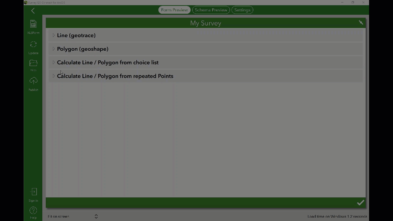
The latest version 3.6 release of Survey123 comes with a number of improvements and new features. One of the most requested features being the ability to create lines and polygons in both the web and field apps. This functionality has been brought to fruition through the geotrace and geoshape feature types.
Lines and Polygons
Draw lines with the Geotrace tool, and create polygon features with the Geoshape tool. These tools are available in both the field and web apps via the new geotrace and geoshape XLSForm question types. Build out these feature types through Survey123 Connect for ArcGIS.
Geotrace
Geoshape

Calculate Line Polygon from Choice List
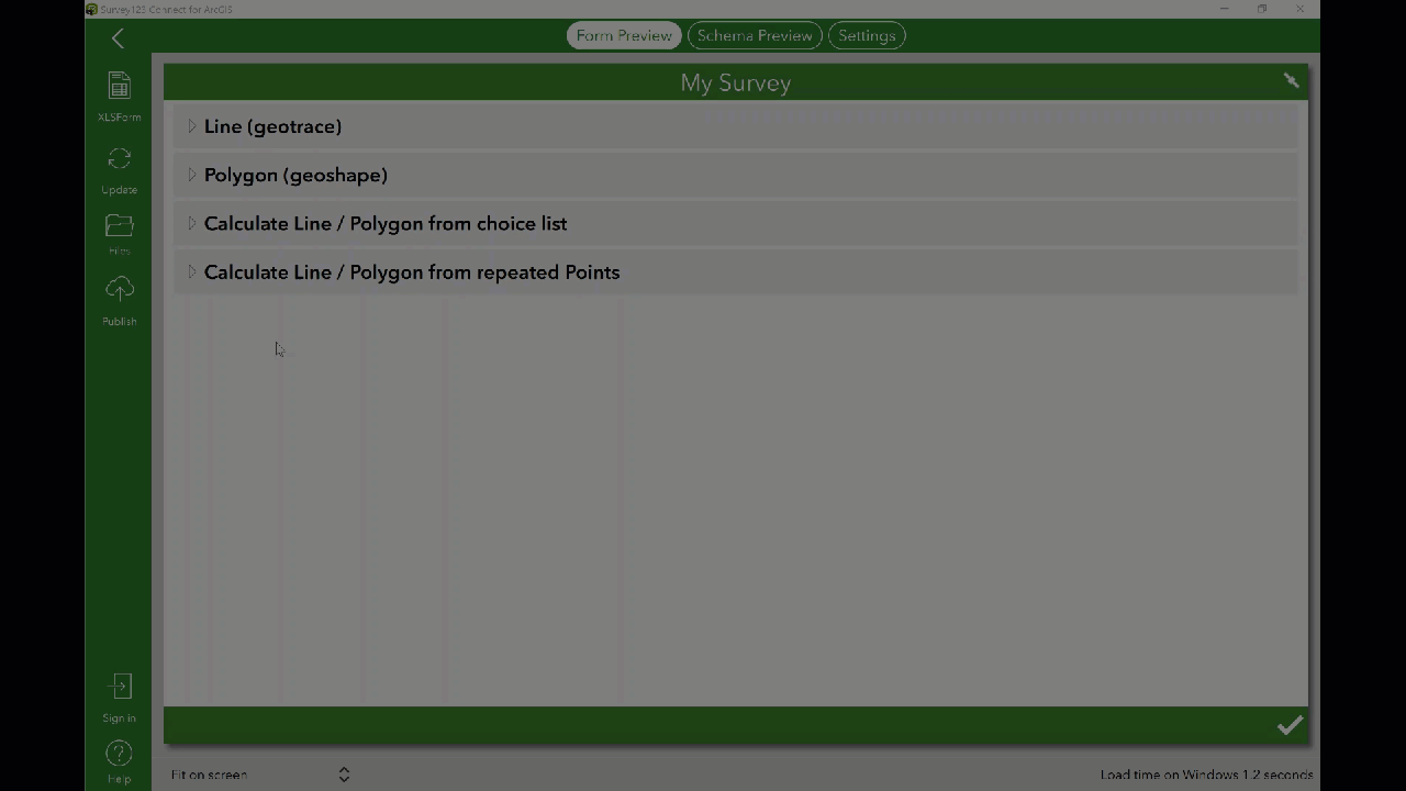
For more information on geotrace and geoshape abilities, check out Survey123 Tricks of the Trade: Lines and Polygons.
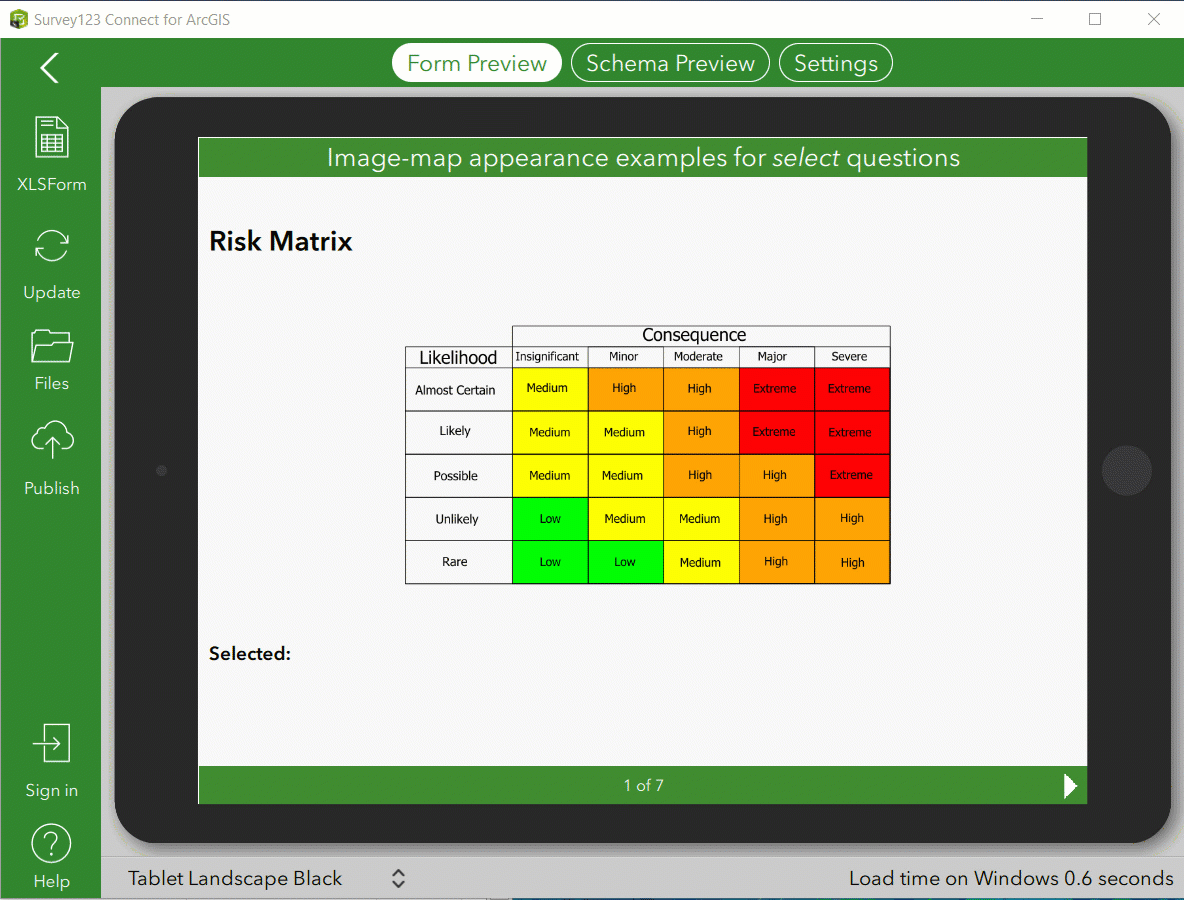
Image-map Appearance
Leverage interactive SVG images in your surveys. Images are linked to a select question. These images allow the user to make quicker, more intuitive choices. Find out more about using the image-map appearance in Survey123.
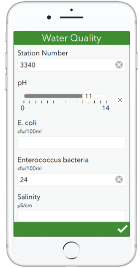
Range Questions
Create a range question with a chosen range of options, customizable slider, and custom color scheme. Range questions display as a horizontal slider, which works well with touch screens.
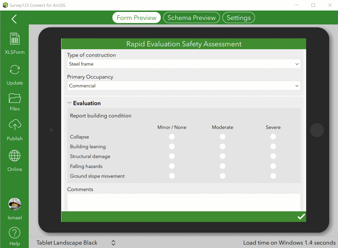
Single Choice Grid
The field app now boasts the web designer’s single choice grid. This table-list view displays as a group of select questions in a grid style. Single choice grid presents a series of choice list questions, resulting in a better end-user experience by creating a compact view of all questions. This style works best when two or three questions share the same list of available choices.
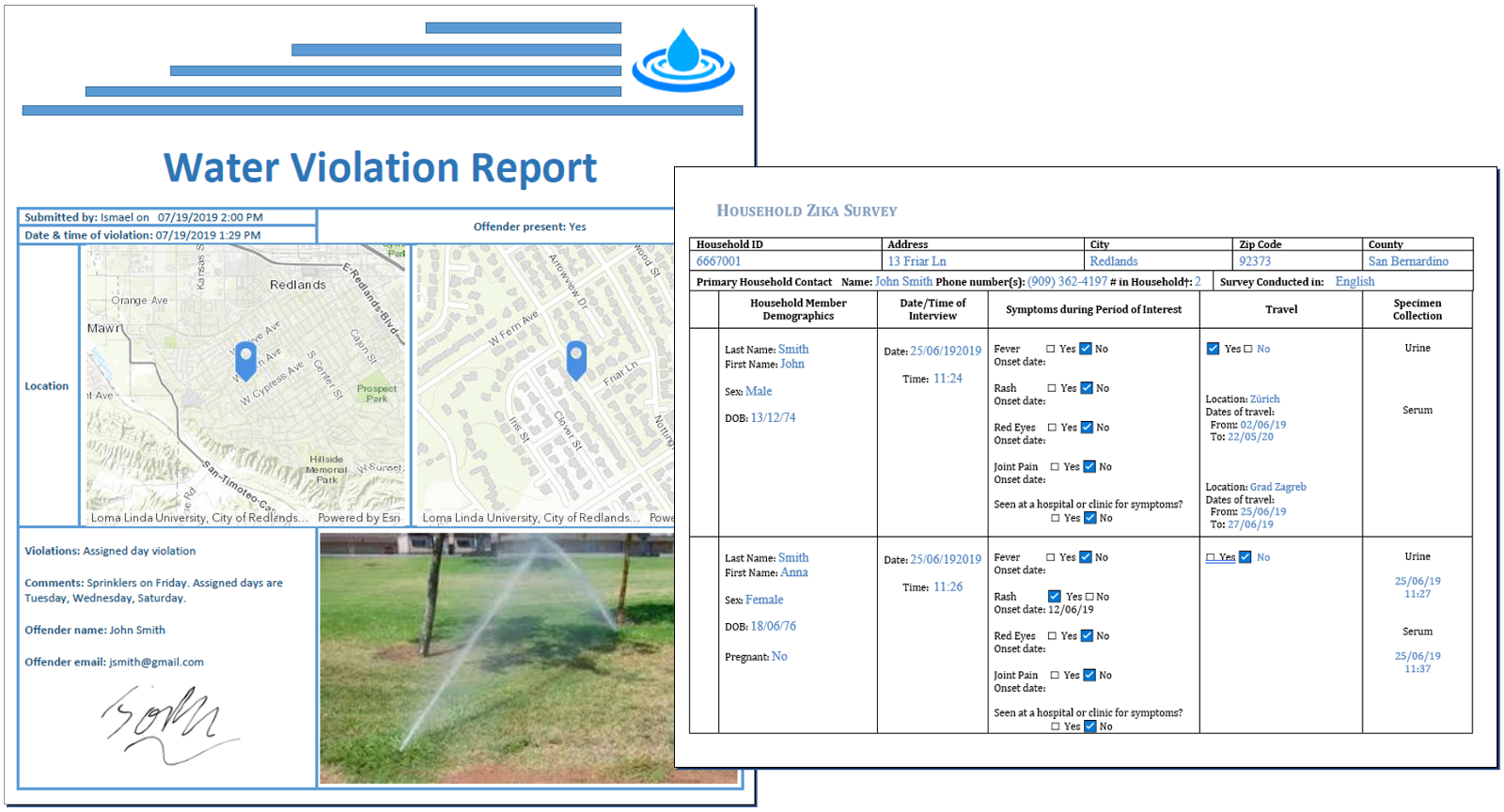
Feature Report Enhancements
Survey123 feature reports give you the power to create high quality printable documents highlighting your Survey123 data. Learn more about Survey123 Feature Reports. An important note: Each generated feature report will now consume 2.5 ArcGIS Online credits.
Bug Fixes in v3.6
The latest update of Survey123 for ArcGIS also comes with 30 critical bug fixes for the web and field apps. These fixes include ensuring consistent behavior of XLSForm expressions, improved barcode scanning abilities, and changes relating to the new iOS 13 update.
Get Support
Is your organization ready to leverage Survey123 for ArcGIS? Are you seeking professional GIS services from industry experts? Start a conversation with our GIS experts to discuss your unique GIS needs.


