
ArcGIS Solutions are ready-to-use GIS maps and apps, built to perform industry specific workflows for your organization. These out-of-the-box solutions are grouped by industries, enabling you to choose the best fit for your organization.
Explore this preview of templates and technologies that are available for rapid deployment from ArcGIS Solutions. These are just a few of the available options within each category, scroll through even more ArcGIS Solutions here.
Business
 Business Resilience is a prebuilt configuration of Web AppBuilder for ArcGIS and Survey123 for ArcGIS. This template helps users visualize and understand all locations associated with their organization. Inspect the status of retail stores, manufacturing plants, and other important facilities.
Market Development leverages Operations Dashboard for ArcGIS to help retail analysts better interpret the overall performance of the business. Go beyond mere spreadsheets. Visualize store success based on regions and categories of sales merchandise.
Defense
 Military Tools for ArcGIS provides a series of mission-based tools that streamline defense and intelligence processes within the ArcGIS platform. Create gridded reference graphics, interactive linear and radial line-of-sight analysis, and military symbols within ArcGIS Pro.
Civil-Military Operations is a customizable solution for Civil Affairs. Including Survey123 for ArcGIS forms, configurable web apps, and various dashboards to assist in the collection, management, and visualization of civil affairs.
Electric
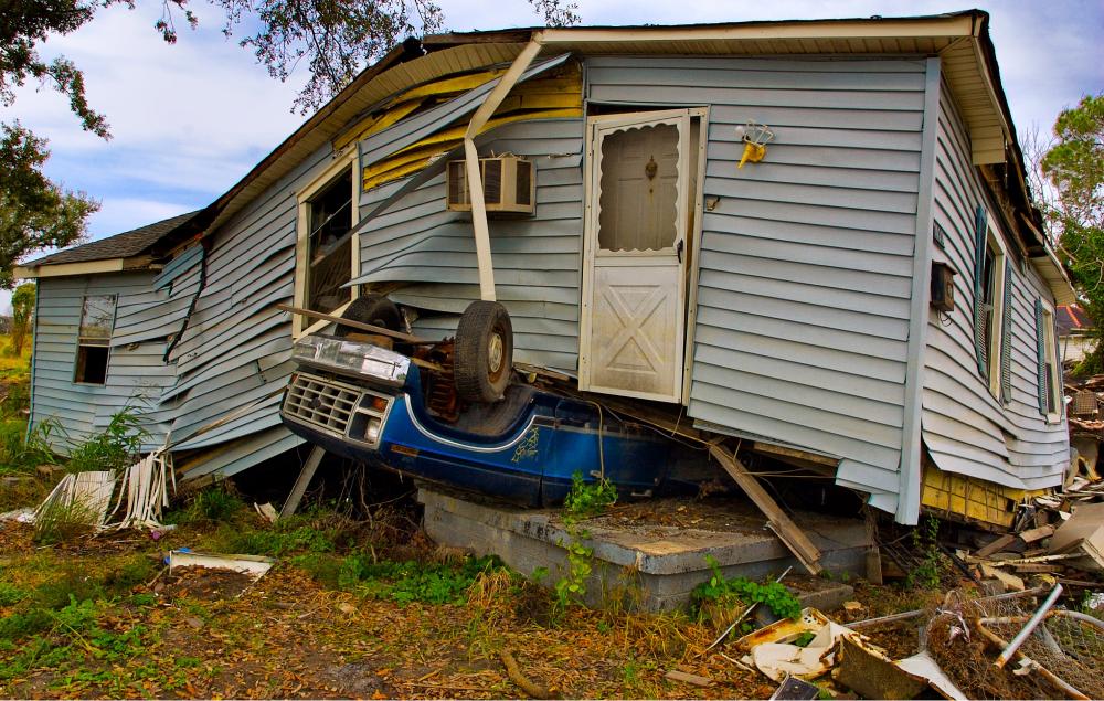
 Damage Assessment Dashboard helps determine the extent of damage created from major events. The dashboard is easily deployed, and equips field crews with the ability to record damages in the field, with immediate updates sent straight to the office. Managers can see the full extent of damages collected in one easy-to-read dashboard.
Hazard Reporting Collector provides field crew with Collector for ArcGIS technology to collect the locations of hazards with their phone or tablet. Attach images of the problem area, and create maps of hazards that may impact working locations.
Emergency Management
 Citizen Reports leverages the GeoForm application, to be used by citizens to report non-emergency events. This form provides citizens with the power to report their observations in their community. This collected information is then promptly shared with public safety and emergency management personnel.
Debris Reporting leverages Collector for ArcGIS, Survey123 for ArcGIS, and Operations Dashboard for the collection and monitoring of debris for emergency management organizations. Determining the location of debris is the first step toward successful clean up.
Gas
 As-Built Mapping provides field staff with the tools to sketch the location of a new or reconstructed main and attach the as-built drawings. Streamline workflows by getting as-built drawings back to the office quickly and efficiently. Field crews leverage Collector for ArcGIS to sketch and share drawings with the office.
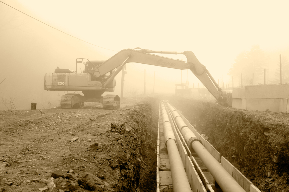
Exposed Pipe Collector is a great solution for collecting the locations of exposed pipelines. Field crews leveraging Collector for ArcGIS can collect the locations of exposed pipelines using their phones or tablets. Gathered data can then be quickly communicated back to the office for further analysis.
Local Government
 Construction Activity Tracker is built using Web AppBuilder for ArcGIS. This solution provides the general public with an easy way to monitor building permits and the status of construction in their community. The public has the ability to locate building permits which are open, under review, approved and closed, providing a transparent view of operations for the community.
Capital Improvement Plan leverages a Story Map Journal template to communicate Capital Improvement Plans with the general public. This means identifying capital infrastructure projects that require renovation, repair, and construction. This tool helps determine the required financial resources to support the timely completion of large projects.
Sewer
 Create 3D Sewer is a configuration guide helping you add elevations to your sewer data, for the purpose of publishing 3D features. The tool includes a workflow that uses interpolation to convert existing 2D features into 3D features that can provide an enhanced visualization of sewer systems.
Water Service Request is built with the ArcGIS GeoForm web app template. This form enables citizens to report on water/sewer issues, and report on stormwater related problems. After citizens report the location of the issue, new service requests can be generated for crew to promptly investigate the situation.
State Government
 Crash Analysis leverages ArcGIS Pro to analyze crash data in order to locate dangerous intersections. This tool can be used by public works, public safety and transportation departments to assign levels of danger to streets, assign crash locations to road segments, and create crash risk maps based on gathered information.
Incentive Zones take advantage of Web AppBuilder for ArcGIS to provide incentives to business owners and corporations. Incentives can encourage new business development, and the expansion of existing businesses. This app can deploy multiple incentives from one or more levels of government.
Stormwater
 Mapping for Small Stormwater Systems leverages ArcGIS Online to create a cloud-based GIS platform for mapping and analyzing stormwater utilities. Your organization will have a suite of ready-to-go apps to support stormwater mapping and workflows.
Water Service Request puts the power in customer hands. A version of the ArcGIS GeoForm template, this prebuilt app enables customers to report issues with water, sewer and stormwater infrastructure. After the public completes a service request form, new service requests are created for further investigation into the problem, creating work orders as needed.
Telecommunications
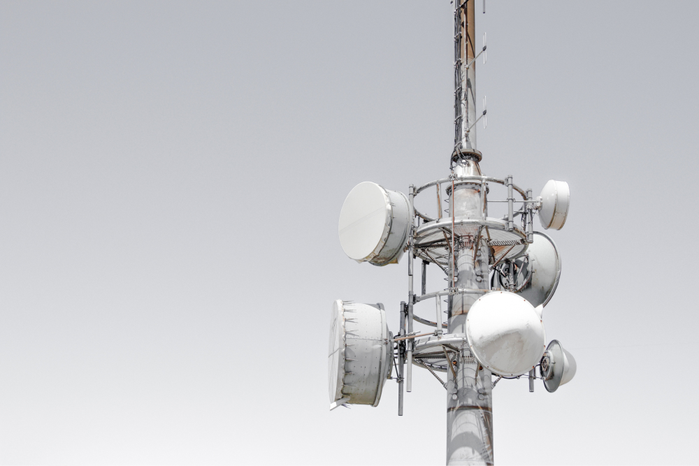 Project Planning Markup allows engineers and planners to draw out current and proposed fiber, copper, and COAX network projects using web map technology. Choose the sketch type from a pre-populated list of choices, and share designs within an organization for streamlined efforts.
Serviceability Lookup leverages ArcGIS Online to provide a public view of services in a given location. Easily embedded on your website, customers get a quick and simple view of service availability in their area.
Utility Network
 Gas Utility Network Configuration creates a utility network that operates like a real world gas network. Providing maps, services, and workflows to aid in data management and analysis. This is a great place to start when building out a digital model for a gas utility network.
Water Distribution Utility Network Foundation offers a model utility network for water resources. Operating like a water distribution network, this solution provides configuration instructions, a schema for water distribution components, rules to define network behavior, and sample data to get started quickly.
Water
 Water Outage provides utilities with the ability to quickly respond to main breaks. This helps reduce water loss, and avoid harmful impacts to customers. This solution includes a series of maps and apps that help an organization quickly locate the main break, alert appropriate parties, inform the public, and monitor response activities.
Watering Violations help identify unauthorized watering events during water restrictions by leveraging Collector for ArcGIS. Helping to enforce water conservation efforts, this solution allows field crews to gather violation information via their phones and tablets. Passing violations along then helps determine appropriate fines to be charged.
Get up and running quickly with the ArcGIS Solutions Deployment Tool
For rapid deployment of any ArcGIS Solution, download the ArcGIS add-in and start browsing the vast catalog of solution options. Deploy a solution to an ArcGIS Online organization or to Portal for ArcGIS. Deployment of your chosen ArcGIS Solution will create all the necessary items, groups, feature layers, maps and apps that comprise the chosen solution. Each solution can be configured post-deployment, to meet the goals and address the challenges of your organization.
Get Support
Looking to go beyond these ready-made template solutions? GeoMarvel can help! Reach out to our industry experts to start a conversation about your unique GIS needs today.


