
It is with great excitement that we announce our recent work with STACH PLLC – a preservation landscape architecture and planning firm based in Asheville, North Carolina, with an extensive project portfolio that includes historic sites like President Lincoln’s Cottage, restoration of historic designed landscapes like the DC World War I Memorial, preservation of ethnographic landscapes including the Alamo Preservation Master Plan, among many others.
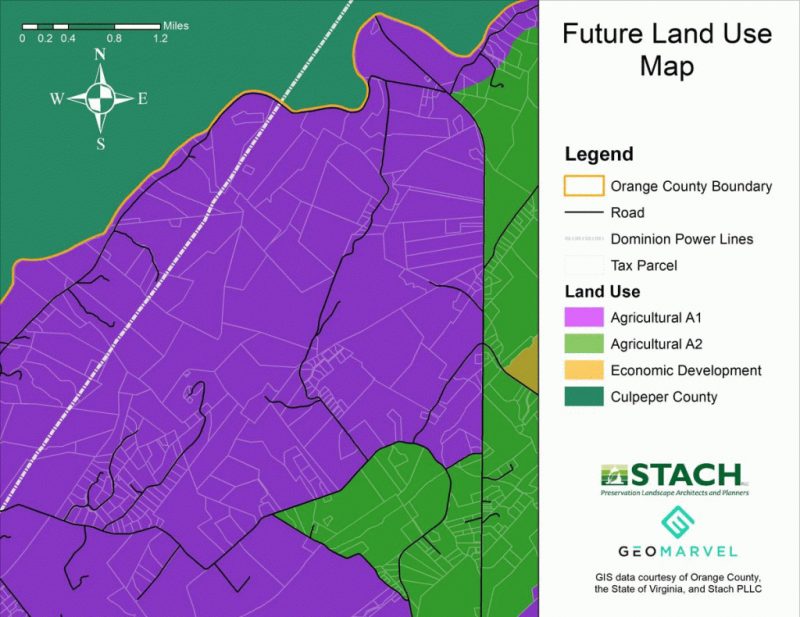
We were tasked with employing our proficiency in land preservation GIS map development to author intricately-detailed maps of STACH PLLC’s most recent preservation effort at Clark Mountain located in Orange County, Virginia.
These maps included various elements of geospatial data that pertained to topography, parcel data, cultural resources (historic sites, places of worship, and cemeteries), land use (zoning of agricultural lands and economic development regions), land conservation (protected lands), natural resources (water bodies, wetlands, watershed boundaries, and shrink/swell soil areas), and zoning/utilities (pipelines, powerlines, communication towers, building footprints, and subdivision boundaries).
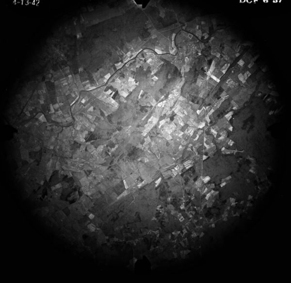
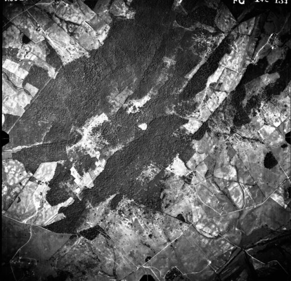
The project also required us to obtain and develop detailed aerial maps from various periods of time, dating back to as early as 1930.
To achieve these cartographic tasks, we leveraged our proficiency in using Esri’s ArcGIS Pro and assembled various geodatabases related to Clark Mountain and Orange County, Virginia. Using these geodatabases in ArcGIS Pro, we were able to develop and export high resolution mapping visualizations for each of the desired contextual maps and aerial images for STACH PLLC to create a general atlas of the property for the property owner and future land trust. Historic aerials were also obtained from the United States National Archives and Records Administration (NARA) located in College Park, Maryland, and the Department of Agriculture’s Farm Service Agency Aerial Photography Field Office based out of Salt Lake City, Utah.

Check out the land preservation GIS map development collection, and for more information on how your organization can employ our GIS services, please visit: https://www.geomarvel.com/our-services/


