
GeoMarvel has a history of partnering with Esri Business Partners. Our most recent partnership with Esri Emerging Business Partner and Esri Startup, AQUAOSO, was nothing short of continuing this trend, taking a great idea and partnering together to bring it to fruition.
As partners of Esri, we are provided a platform of technology essential to our success; however, even more essential to our success and growth is Esri’s constant promotion of collaboration opportunities with other members in its Partner Network. We plan to continue to support and collaborate with Esri Business Partners as we grow together and further leverage The Science of Where.
This most recent partnership experience with AQUAOSO has been nothing short of outstanding, creating a learning experience for members from both organizations. There is no doubt that this will not be the last product we develop together!
Together, GeoMarvel partnered with AQUAOSO to develop a commercial platform that supports their customers in researching land as it pertains to water. The product leverages data that is considered to be the best available for the industry. The product is built using various components of the ArcGIS Enterprise and ArcGIS Online, along with today’s best available web application development tools and practices.
The platform is being offered by AQUAOSO to its customers to create a single application to explore, visualize, report, and analyze parcel data with additional information that surrounds water details.
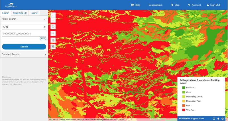
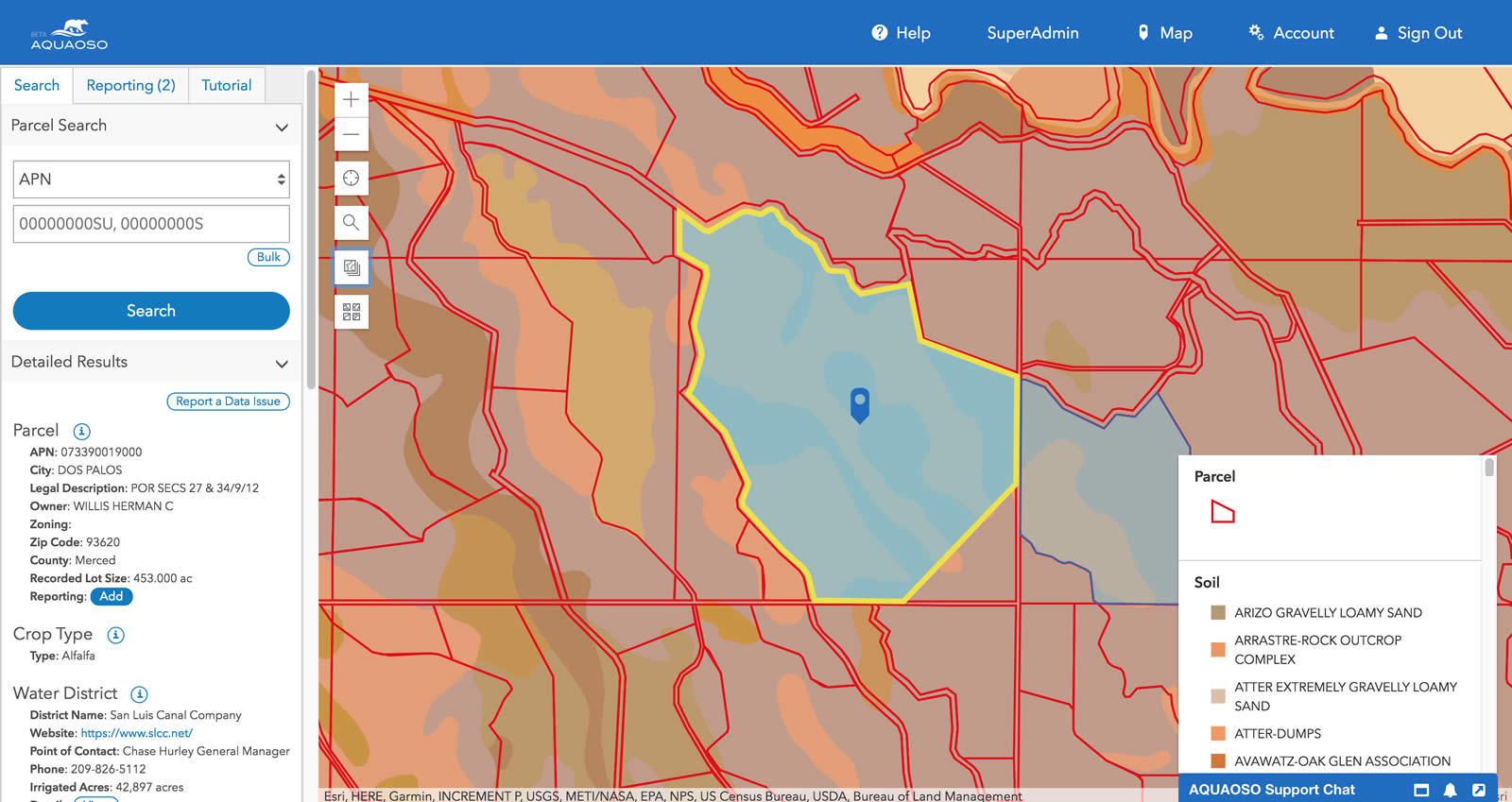
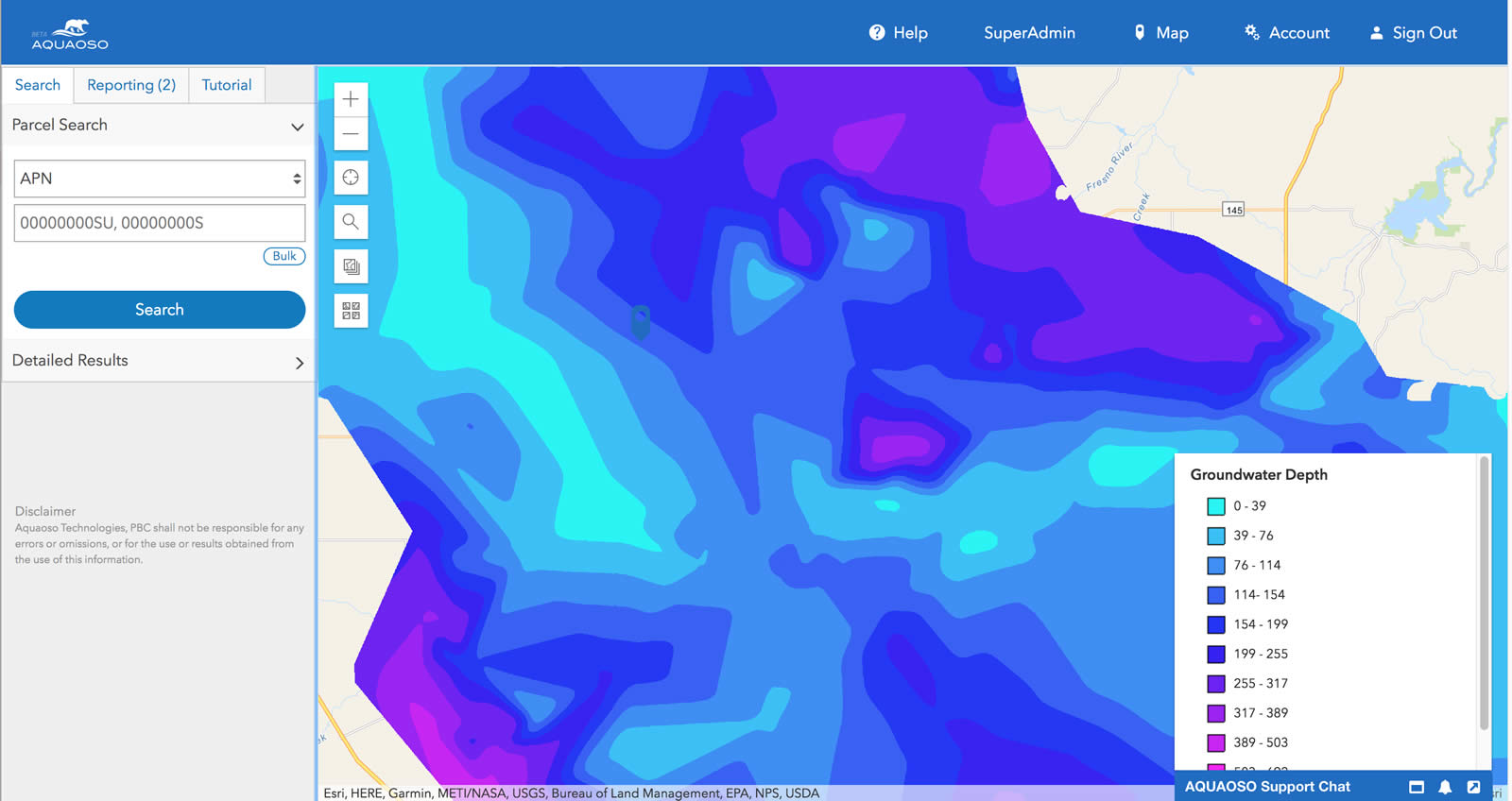
The development of the platform required experts from GeoMarvel and AQUAOSO to work together to leverage their respective expertise to create a cutting edge application for AQUAOSO’s commercial customers. The technology capabilities involved during the platform’s development included security, data, and web services & API.
Web Map Service is heavily used throughout the platform to create a programmatic way of visualizing and accessing the data layer attributes. Each of the data layers is served using the ArcGIS Server – the most powerful and capable geospatial web mapping server in the industry. As part of the ArcGIS Enterprise environment, ArcGIS Server allows for the leveraging of a scalable and standardized RESTful API, giving platform end-users the ability to leverage the data seamlessly.
If you are interested in learning more about the AQUAOSO platform, you can find them here. To learn more about GeoMarvel and its other partnerships, services, and products, click here.


